
SOME 1930 VIEWS OF EPSOM
A few years ago, our late webmaster, Peter Reed, was pleased to receive from Jim Sapsed copies of an interesting set of 12 postcard views of Epsom. These appear to date from about 1930 but, as “LATEST” on their wrapper has been deleted, were probably sold later than that.
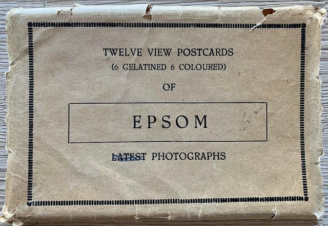
One of the images was used in our 2020 article about Epsom’s “Tower House”, and another in an update of our article about St Ebba’s. It is understood that Peter Reed intended to publish the whole set on this site but, sadly, this was one of several things that remained on the busy man’s “to do” list at his untimely death in late 2023. This article honours his plan.
The postcards are a pretty random set, and are presented here on a zig-zag route through central Epsom, up over the Downs and out to St Ebba’s. We’ve added captions that are fuller than on the postcards – and, where appropriate, have included clickable links to descriptive material elsewhere on the website.
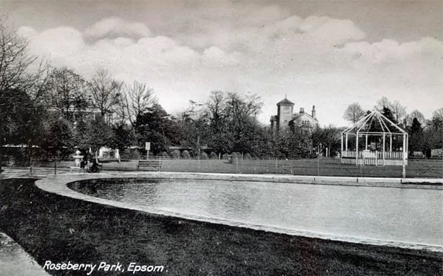 A view across the lake in Rosebery Park (here with a common spelling mistake) to the interwar Bandstand (a relic of the 1924 British Empire Exhibition at Wembley) and, in the background, the unusual Tower House.
 As this road is on the way to and from Leatherhead, it would be quite logical for it to be called “Leatherhead Road” (as on the card), but its name has long been “South Street”.
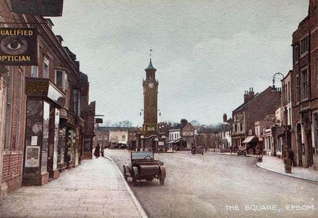 Although noted on the card as “The Square” this is commonly called the Market Place, although it is formally the western half of the High Street. As can be seen, traffic then passed each side of the iconic Clocktower.
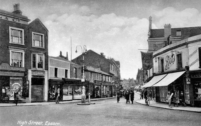 The eastern half of the High Street. All the buildings on the right of this picture (which include the dominant Railway Inn) were demolished a few years later to make way for the late 1930s widening. (And the low level buildings on the left were replaced in the 1980s.)
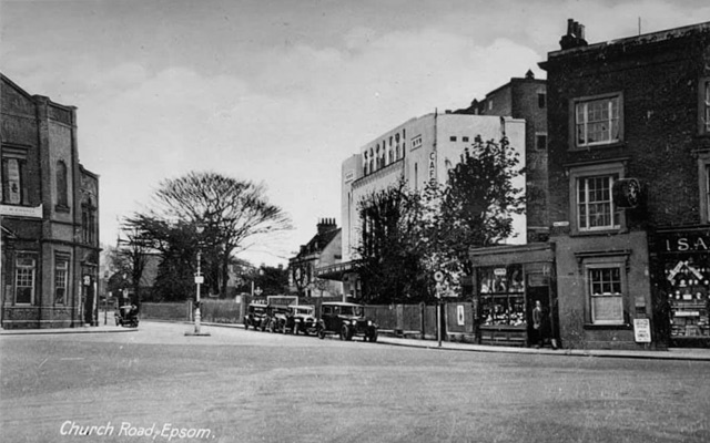 Contrary to the postcard’s title, this is a view up Church Street – named for St Martin’s (as in the next postcard), but which also contains the Baptist Church (in the left background here) and, further up, the now-closed URC. Church Road – also named for St Martin’s – runs from East Street, past the old St John’s and on to the rear of St Martin’s.
This view is taken from about the same spot as the previous one, but after a quarter turn to the left. (The building on the right, which remains to this day, is the other half of the one on the left of the previous postcard.) The Capitol cinema in the centre here had opened in 1929 (and closed in 1960).
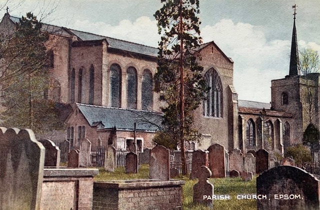 In the early 1900s, work began on replacing the 1820s iteration of St Martin of Tours with a larger building. In the event, only the East End (on the left – and about 20 years old – here) was completed. The church’s spire seen here was removed after storm damage in the late 1940s.
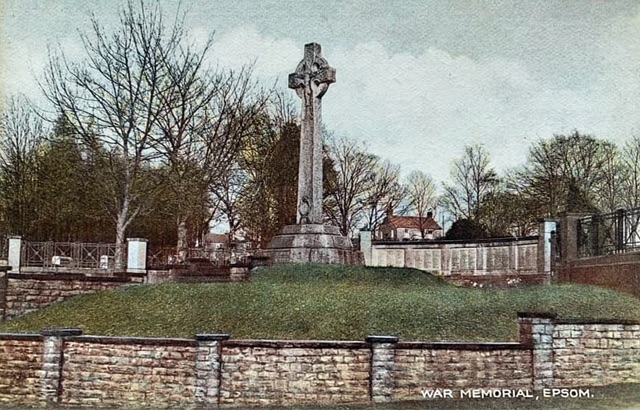 The War Memorial in Ashley Road was erected in 1921 to commemorate Epsom’s losses in the Great War (WW1) – the panels listing the names of the fallen being added in 1923. (Ewell has its own WW1 memorials at the Dipping Well and in St Mary’s Churchyard.) The Ashley Road memorial was, in due course, updated to commemorate WW2 casualties from both Epsom and Ewell, with the names of the fallen being listed in the Borough’s Book of Remembrance displayed in the foyer of the Town Hall.
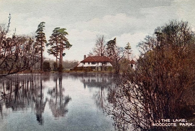 A detour across the Downs to the Lake at Woodcote Park – not, it has to be said, that estate’s best-known feature.
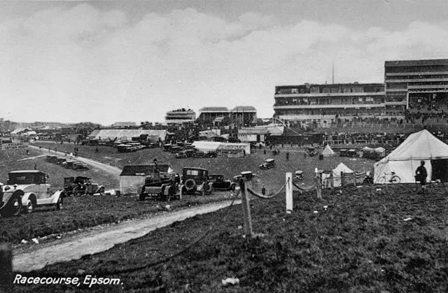 To the crest of the Downs for the world famous Epsom Racecourse. (The modest crowd size here means that this picture is not of a Derby meeting.
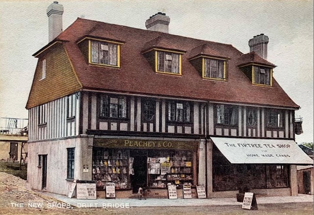 Down to the Drift Bridge and “The New Shops” at what are today numbered – left to right – 203 and 201 Fir Tree Road.
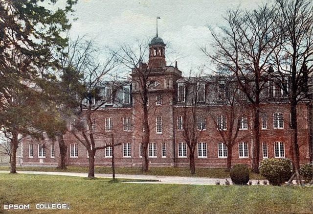 Round the corner to Epsom College, although this is the Newsom Building (for two of the College’s Houses) rather than the main block.
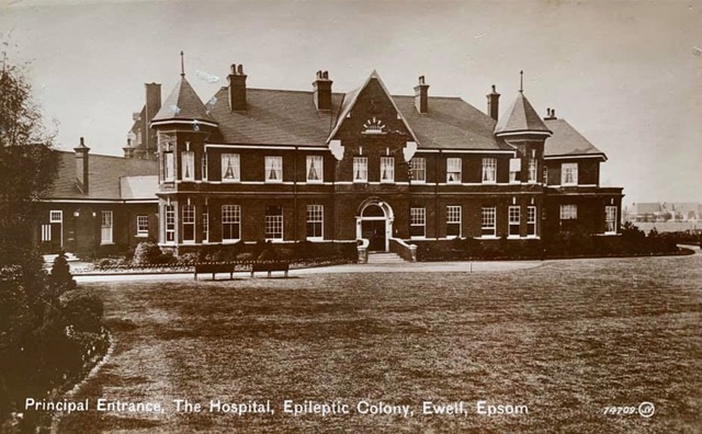 And finally, out along Hook Road to “The Epileptic Colony” (later named “St Ebba’s”), which was part of the Epsom Cluster.
Roger Morgan 2024
with thanks to Jim Sapsed for the images