
EWELL HERITAGE TRAIL
SECTION 2: WESTERN LOOP FROM THE UPPER MILL TO MILL LANE
 The Ewell Heritage Trail.
(Click to enlarge)
This loop section (which takes about 1½ hours to complete) begins at the Upper Mill, off Kingston Road as reached at the end of Section 1 – and ends across the road from Upper Mill, in Mill Lane at the start of Section 3.
From the Upper Mill, cross the river and follow the footpath on its left bank. If you are lucky (as the writer was in February 2023), you may spot a kingfisher on this stretch of the river.
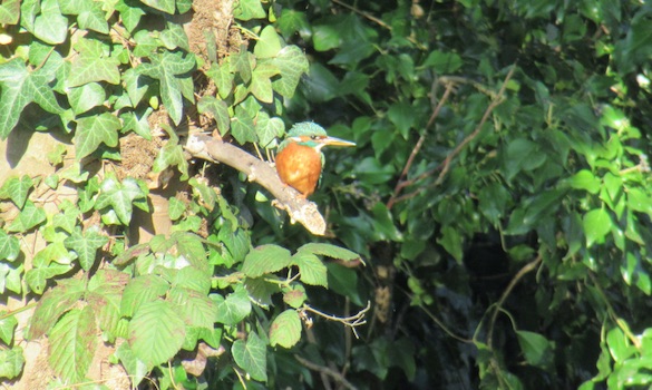 A Hogsmill kingfisher.
Photograph by Roger Morgan © 2023
A hump-backed bridge takes the riverside path over a side stream of the Hogsmill. Then you pass by the ruins of the Lower Mill which, like its upper partner, was run by Hall and Davidson. Previously it had made paper. The Mill was destroyed by fire in 1938, pictures of which are in the article at this link – which also covers the Upper Mill, at the end of Section 1 of the trail. The recently refurbished eighteenth-century miller’s house can be seen on the far side of the river – although, when trees are in leaf, you may need to move from the path to the water’s edge (take care!) to get a good view.
 Left: The Lower Mill in about 1930.
Photograph courtesy of Bourne Hall Museum.
Right: The Miller’s House today – from about the same viewpoint.
Photograph by Roger Morgan © 2023
The following extract from the 1933 Ordnance Survey map will help clarify how things used to be.
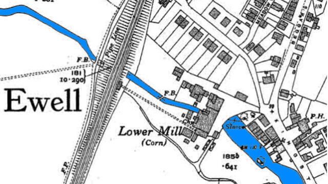 Extract from the 1933 Ordnance Survey map (in which, for clarity, the Hogsmill has been coloured blue).
Shortly after this, you will come to the railway bridge (10) in the embankment of the railway (in the section between Ewell West and Stoneleigh). The bridge was originally built to provide passage for the Hogsmill. The decking to allow pedestrian use is a more recent addition.
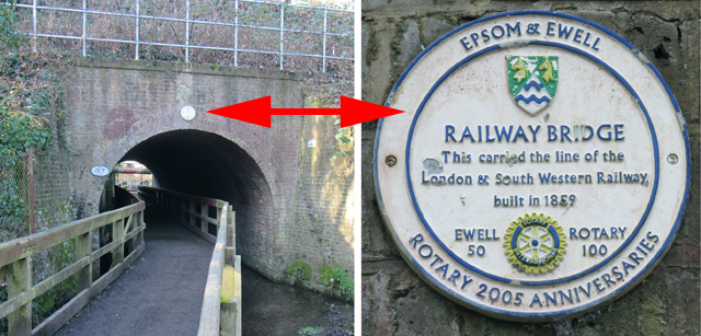 The Railway bridge (10).
Photographs by Roger Morgan © 2023
Pass under the bridge, turn right along the public footpath and then turn left onto open land besides the Hogsmill.
[NOTE: You may be interested also to see the Borough’s guide to the Hogsmill Local Nature Reserve ]
Here, just below the houses to your right, was the field where William Holman Hunt painted The Hireling Shepherd. His fellow Pre-Raphaelite, John Millais – who occasionally stayed with Holman Hunt in Ewell (see Rectory Farm at stop 16 in Section 3 of this trail) – found a site for his painting of Ophelia further downstream, beyond the reach of this Trail.
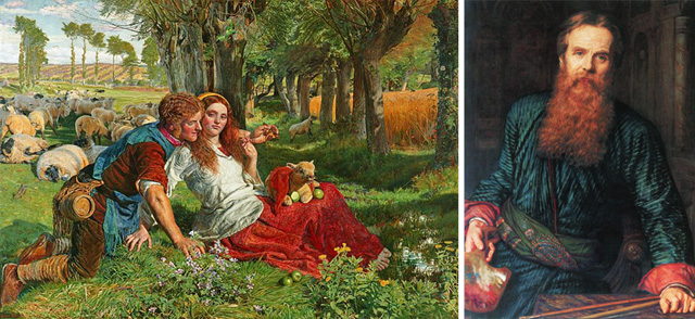 The Hireling Shepherd (1851) and an about contemporaneous self-portrait of the artist, William Holman Hunt.
Public domain images from the Wikipedia article.
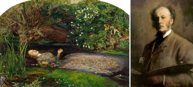 Ophelia (1851-52) and an about contemporaneous self-portrait of the artist, John Millais.
Public domain images from the Wikipedia article.
Continuing beside the right bank of the river you will pass over the site of Ewell’s gunpowder mills, now visible only as cropmarks in dry weather. On the far side of the stream is Chamber Mead, the common meadow of the medieval village. (There are stepping stones across the river here. When it’s very muddy, you can cross the river here and use the hard-surfaced path on its left bank.)
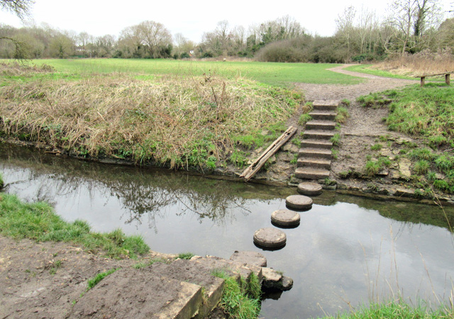 Stepping Stones across the Hogsmill, with Chamber Mead beyond.
Photograph by Roger Morgan © 2023
After about half a mile from the railway bridge, by a bridge over the Hogsmill, you reach a T-junction with a tarmac path. Turn right on this and, within a few yards, then left through the gate to enter the grounds of Ewell Court. From the gate, you will see the 18th Century and Grade II listed Packhorse Bridge (Storyboard D) over the stream from the lake in front of Ewell Court House.
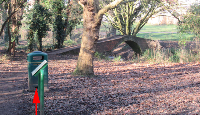 The Packhorse Bridge in the grounds of Ewell Court and, as arrowed, the trail’s standard storyboard.
Photograph by Roger Morgan © 2023
The text of Storyboard D is: Alexander Bridges, the eighteenth-century owner of Avenue House (as Ewell Court was then called) developed the river Hogsmill until it supplied enough power to run incorporating mills and a corning house for the manufacture of gunpowder. These buildings, like the powder magazine, were set apart from each other beside a series of millponds so that, if one of them blew up, the blast would be absorbed by the water and not set off the rest. Despite this, there were many explosions: one of the first, in 1757, was felt in London and mistaken for an earthquake.
In the nineteenth century, the Bridges family brought in a Scottish manager, John Carr Sharpe, to oversee the mills. In 1875, the mills had to close down when the Government’s Explosives Act imposed safety regulations with which they could not comply.
At the end of June 1851, William Holman Hunt and John Millais came down to Ewell to find backgrounds for two new paintings that they had in mind – “Ophelia” for Millais and “The Hireling Shepherd” for Hunt. The two young men set out down the river Hogsmill to find suitable sites for their paintings. Hunt chose the meadows looking north towards the fields of Ewell Court Farm, while Millais continued downriver for two miles towards the slopes beneath Old Malden Church.
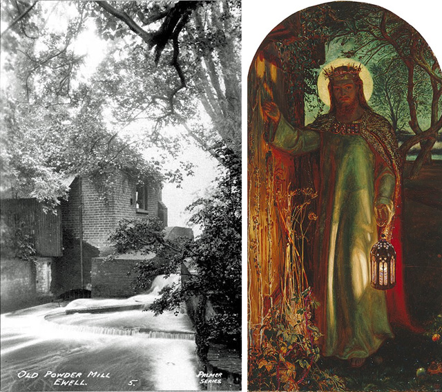 Left: The only known photograph of one the Ewell Gunpowder Mill buildings c.1900
Image courtesy of Bourne Hall Musem
Right: “The Light of the World” (1851-54) by William Holman Hunt, the door in which is understood to be one at Ewell’s gunpowder mills.
Public domain image via Wikipedia
It may be helpful at this point to see the the following map of Ewell Court Park as displayed for reference at various points in the grounds. Arrowed here are this trail’s entry and exit points. You will see that, to visit Ewell Court (11), you continue northeast (and slightly uphill) from the Packhorse Bridge
 The Borough’s map of Ewell Court Park.
(Click to enlarge)
Photograph by Roger Morgan © 2023
Ewell Court (11) was first a farmhouse, then the manager’s house for the gunpowder mills, before being enlarged as a mansion in 1879.
 Ewell Court House (11).
Photographs by Roger Morgan © 2023
Leaving Ewell Court behind, follow the stream out through the park and, outside the gate, cross the river, passing a children’s playground on your left. This is in the corner of the Poole Road Recreation Ground. Continue up the right hand boundary of the recreation ground up to the entry (on Poole Road) and turn left. At the end of Poole Road tum right into Heatherside Road and, in about 50 yards, then left into Church Road. You will pass All Saints Church (12) which was built in 1893, funded by the Bridges family of Ewell Court to serve the new and then small community of West Ewell.

All Saints Church
Photographs by Roger Morgan © 2023
West Ewell grew enormously during the last century and it is now a surprise to see – in the postcard below – how rural All Saints’ setting was in the early 1900s.
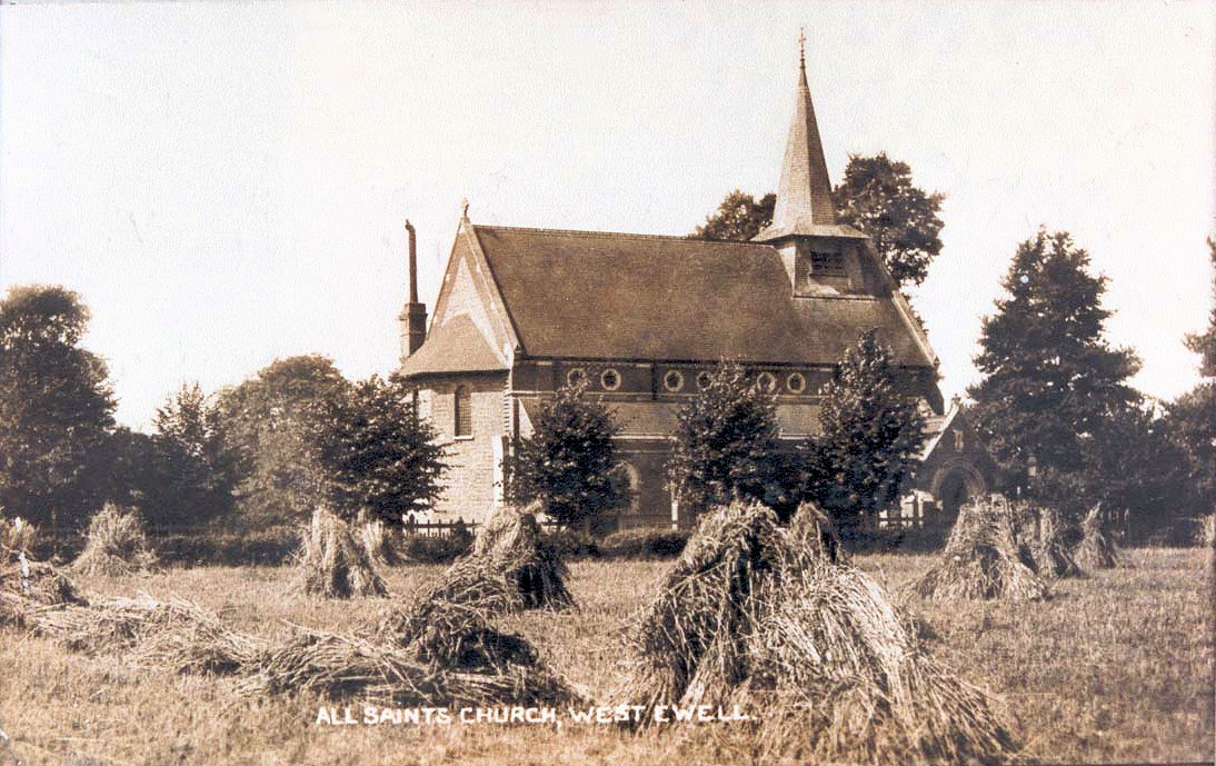 All Saints Church in about 1910.
Image courtesy of Bourne Hall Museum
Continue past the turning on the left into Fulford Road and go through the pedestrian opening in the railings ahead of you. As you enter Plough Road, the site of the long-demolished Black Cottages is to your left. These housed the workers in the nearby gunpowder mills on the Hogsmill.
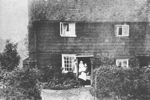 One of Plough Road’s long-lost “Black Cottages” that housed workers in the gunpowder mills.
(Weatherboarding like this was traditionally painted with black pitch, not white paint.)
Image courtesy of Bourne Hall Museum.
Turn right and proceed up Plough Road. The original 2005 guide mentioned The Plough to be found shortly before the junction with Chessington Road. The pub closed in 2007 and its site redeveloped as what is now 1-8 Park Farm Court.
On Plough Road’s corner with Chessington Road are some weatherboarded properties (13), built by the Baker family.
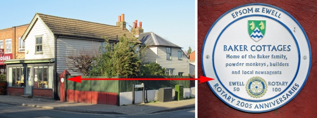 The Baker Cottages (13).
Photographs by Roger Morgan © 2023
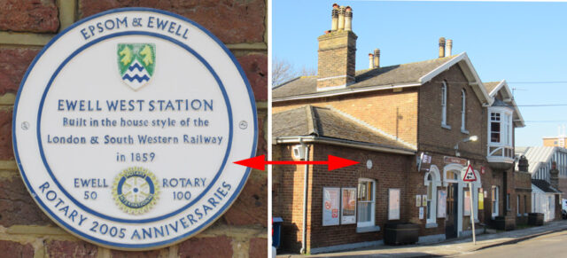 Ewell West Station (14).
Photographs by Roger Morgan © 2023
Carry on to the traffic lights and turn left, following the clockwise one-way system. Cross over Old Schools Lane and, ,just as some more traffic lights come into view, turn left to find one of Ewell’s oldest buildings, a house called Fitznells (15), a former medieval hall (see the Wikipedia article). It was once occupied by Vivienne Price, who founded the National Children’s Orchestra from there in 1978.
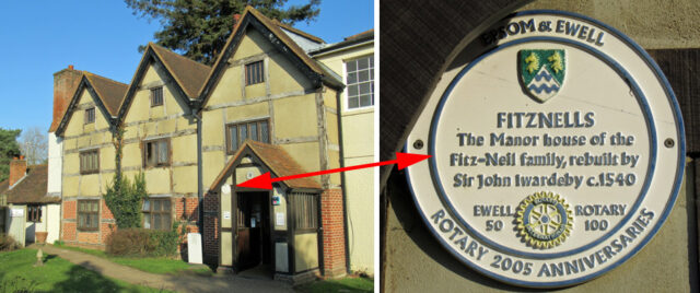 Fitznells Manor (15).
Photographs by Roger Morgan © 2023
Continue round the one-way Chessington Road to the next set of traffic lights, between the Horse Pond and the Upper Mill Pond. Turn left along Kingston Road and, in about 100 yards (by the Upper Mill where this Section began), turn right down Mill Lane. This rejoins the short walk, which is completed in Section 3.
Section 1: Dorset House car park to the Upper Mill
Section 2: This page
Section 3: Mill Lane to Dorset House car park
Developed from the original text by Roger Morgan, 2023