
The Elms, London Road, Ewell.
Later renamed The Grange
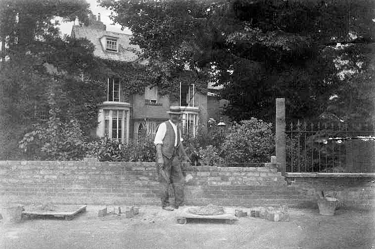 Mr Palmer, the bricklayer, at The Grange (formerly The Elms)
Image courtesy of Bourne Hall Museum
 Extract from a 1866 version of the Ordnance Survey Map
The Elms on London Road is highlighted in yellow
This building started off as The Elms but later, probably early 1900’s, it was renamed The Grange but only after the original The Grange (also known as The Ewell Monastery and highlighted red on above map) was demolished.
Edwards’ Companion to the Road from London to Brighthelmston (c.1788:) describes his route from London past Nonsuch as follows:
XII-1-44 (i.e. at 12miles 1 quarter miles and 44 rods) A gradual descent begins.
XII-1-56 (i.e. at 12miles 1 quarter miles and 56 rods) On the right is the organ, a public house in the occupation of Mr. Thomas Martin.
XII-2-00 (i.e. at 12miles 2 quarter miles) Turnpike Ewell Turnpike gate and descent ends.
XII-2-28 (i.e. at 12miles 2 quarter miles and 28 rods) Mr. Vevers Academy Opposite the angle formed by the road, on its turning to the left is a genteel house, the property of Joseph Shaw, Esq. in the occupation of Mr. William Vevers, who keeps an academy here.
XII-2-72 (i.e. at 12miles 2 quarter miles and 72 rods) Ewell Church On the right is Ewell church, it consists of a square tower in which is six bells, and in the church is an organ. EWELL
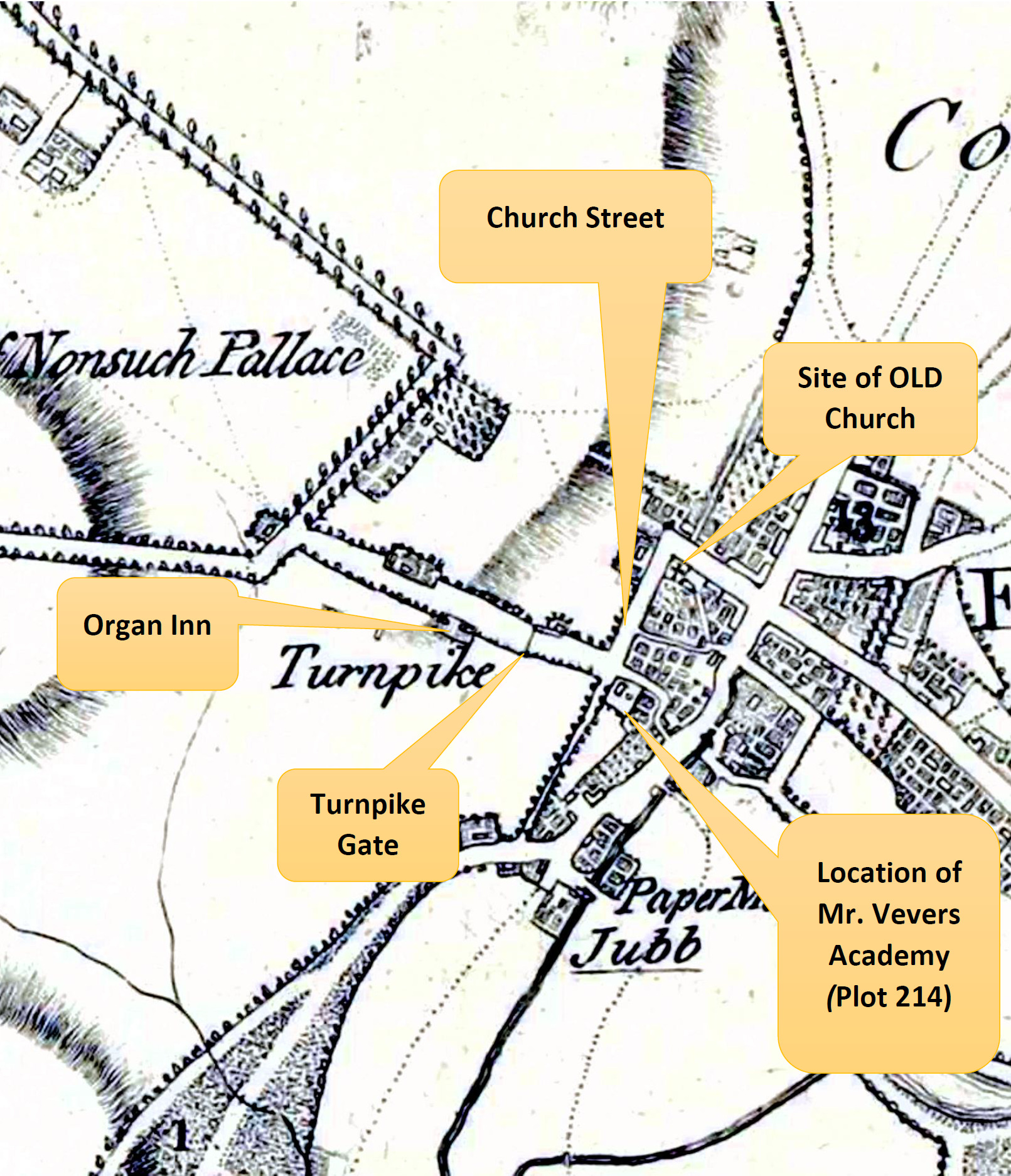 Map extract from Edwards Companion.
Important: this map is not in the same orientation as other maps on this page.
The 1803 Enclosure Map shows the situation a few years later
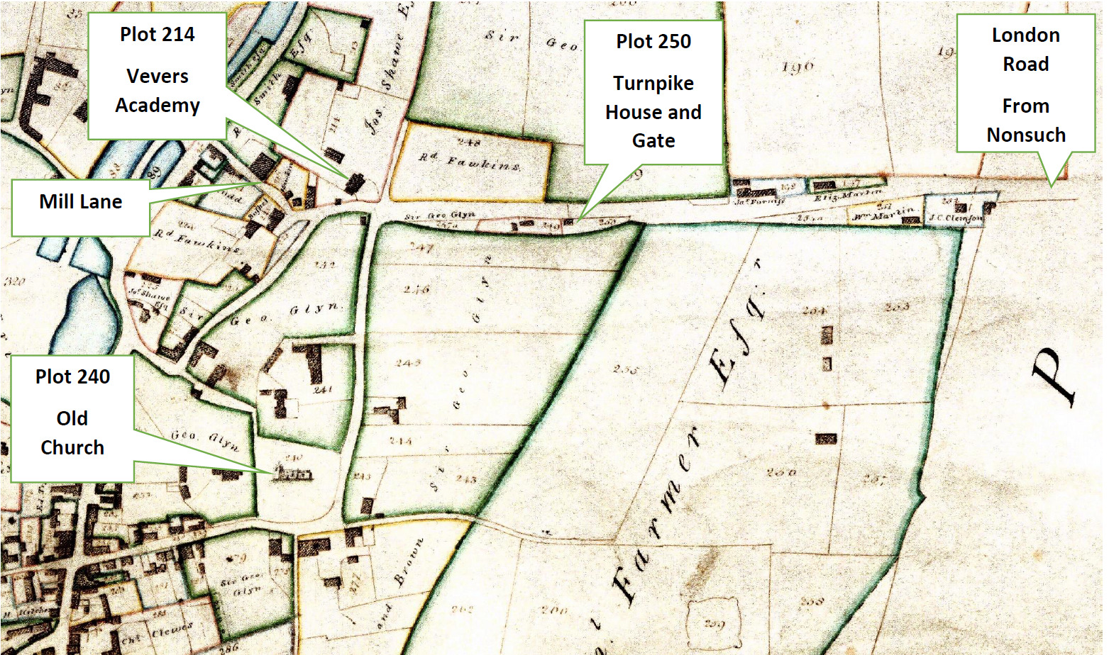 An annotated version of the 1803 Enclosure Map pointing out key plots and Mill Lane
Important: this map is not in the same orientation as other maps on this page.
Click image to enlarge
We think that William Jones, schoolmaster of Ewell ran the academy till his death c.1779 when it was taken over by Mr and Mrs Shield who formerly had run an academy in Islington.
The Preceptor’s Assistant or Schoolmaster’s Guide: Being a Compendium of Arithmetic adapted to the use of schools was published by John Shield, Master of the Academy in Ewell, Surrey was published in 1780.
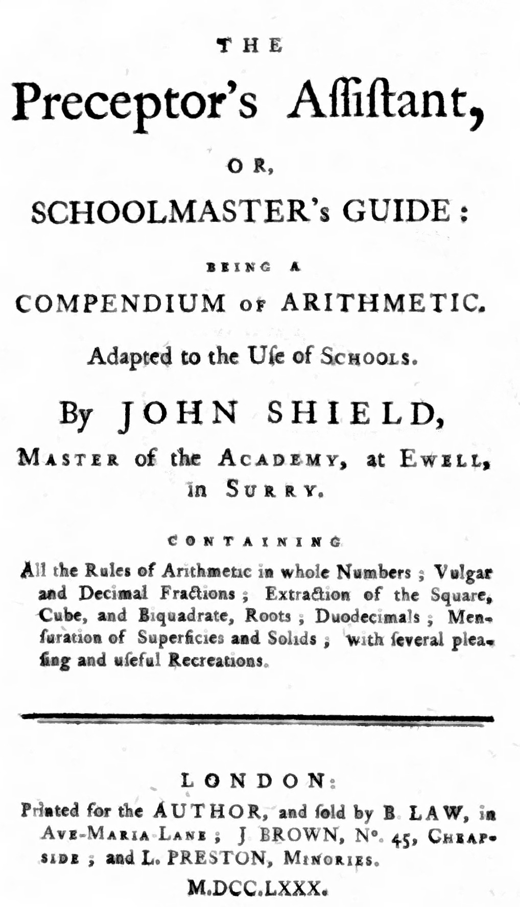
It contained the following advertisement:

Mr Shield died in 1786 and according to Edwards the academy was taken over by Mr William Vevers. We don’t know how long Mr Vevers carried on trading as Ewell Academy but it wasn’t for long as around 1809 Monger’s School at the Old House Ewell on Mongers Lane, used the name Ewell Academy but as a mixed sex boarding school.
During the mid 1800s The Elms became the property of the Carlisle Family
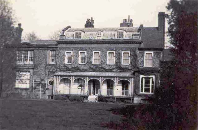 The Grange (formerly The Elms)
Image courtesy of Bourne Hall Museum
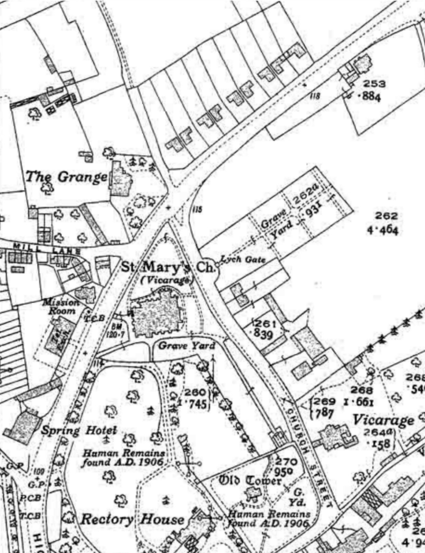 The 1933 OS Map showing that The Elms is now called The Grange.
Peter Reed 2023
Appendix
List of occupiers taken from from local directories
| Year | |
| 1846 | Stowers Thomas, esq (listed but no address given) |
| 1852 | Stowers Thomas, esq (listed but no address given) |
| 1855 | – |
| 1859 | Stowers Thomas, esq |
| 1862 | Stowers Thomas, esq |
| 1867 | Stowers Thomas, esq |
| 1875 | Stowers Thomas, esq |
| 1878 | Carlisle William Thomas |
| 1882 | Carlisle William Thomas |
| 1887 | Carlisle William Thomas |
| 1890 | Carlisle William Thomas |
| 1895 | Carlisle Miss |
| 1899 | Carlisle Miss |
| 1903 | Carlisle Miss (The Grange) |
| 1905 | Carlisle Miss (The Grange, London Road) |
| 1913 | Carlisle Miss (The Grange, London Road) |
| 1915 | Carlisle Miss (The Grange, London Road) |
| 1918 | Carlisle Miss (The Grange, London Road) |
| 1922 | Carlisle Miss (The Grange, London Road) |
| 1924 | Perkins Major Norman C. (The Grange, London Road) |
| 1927 | Perkins Major Norman C. (The Grange, London Road) |
| 1930 | Perkins Major Norman C. (The Grange, London Road) |
| 1934 | Perkins Major Norman C. (The Grange, London Road) |
| 1936 | Perkins Major Norman Chichester. (17 London Road) |
| 1938 | Perkins Major Norman C. (The Grange, London Road) |
| 1940 | Perkins Mrs (17 London Road) |
| 1952 | Perkins Mrs F. (17 London Road) |
| 1956 | Land probably became part of St. Mary’s close |