
World War 2 Composite Bomb Map
 A Dornier DO 17 Z airplane drops bombs
This file is licensed under the Creative Commons Attribution-Share Alike 3.0 Germany license
Attribution: Bundesarchiv, Bild 101I-341-0489-13 / Spieth / CC-BY-SA
During World War 2, records show that 1,613 incendiaries and 64 oil bombs fell in the Borough between September 1940 and June 1944, although only 410 can be substantiated. In addition, 440 High Explosive bombs and 2 Parachute Mines fell in the same period, although only 134 can be substantiated. Of these, 43 failed to explode.
These killed 25 people and injured 168. 106 properties were destroyed.
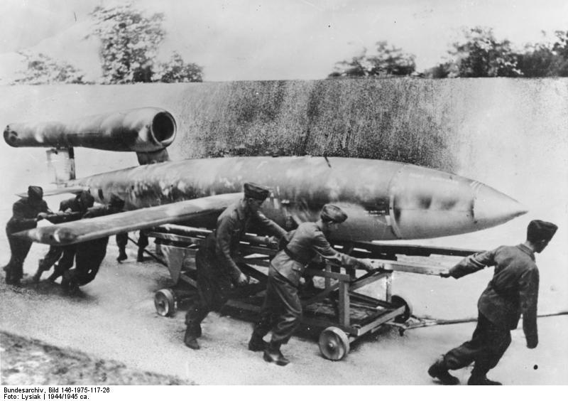 ‘Doodlebugs’ were launched from occupied France
This file is licensed under the Creative Commons Attribution-Share Alike 3.0 Germany licence
Attribution: Bundesarchiv, Bild 146-1975-117-26 / Lysiak / CC-BY-SA
Between June and October 1944, 29 V1 Flying Bombs (known as ‘Doodlebugs’) fell. These killed a further 13 people and injured 251.
The following Map shows where bombs of all types fell in the Borough, and the date where known. It also includes the location of Air Raid Facilities and Defence. (Click here for maps showing only the location of V1 strikes and high explosive bombs.)
Due to the large amount of data it has been necessary to divide the area into six, as follows:
North;
South;
East;
West;
Central (North);
Central (South).
Click on a marker and a pop up information box opens. Use the + and – buttons on the left to zoom in and out, and if you hold the left mouse button down while on the map you can drag (move) the map as desired. There is an alphabetical list of locations alongside and by clicking on an entry the relevant location displayed. If your mouse has a scroll wheel, this can be also be used to zoom in and out; you may find this easier than using the + and – buttons. You may need to select ‘View’ then ‘Refresh’ (alternatively ‘F5’) to see all the icons and controls.
Alternatively, click on the relevant area on the map below:

Text and Map by Nick Winfield
March 2014
ARP Booklet
A booklet detailing the Air Raid Precaution arrangements for Epsom and Ewell was produced in 1938 and thanks to Bourne Hall Museum we have a scan if it.
 Click Image to open